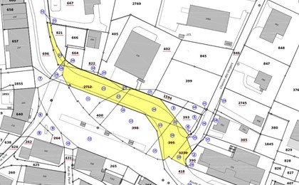
Excerpts from official cadastral surveying plans
-
An extract from the official cadastral survey plan is a map which is used for information and to locate plots. This extract is necessary for:
- Your personal information
- For a sale
- To study a construction project
-
If you need an extract of the cadastral plan for a plot of land, a district, a region, a municipality or other, GEO4ME can provide you with this information in various formats:
- Paper
- Digital: PDF, DWG, DXF, Shapefile, Interlis or other according to your request.
This service is offered to you when you order an official site plan for the survey.

Site plans for public inquiry
A site plan for a public inquiry is an official document, signed by an official surveyor registered in the federal register, upon which your building project is geographically located, along with the geometric details of your project and other useful information. This document must be sent to the competent authority together with the public inquiry file.
If you have a project for the construction or modification of a building, GEO4ME is there to advise you during the different stages of the investigation.

You need a public inquiry for different projects, such as:
-
- Construction of a new building (residential, agricultural, industrial, commercial)
- Construction of a garage
- Construction of a carport
- Construction of a garden shed
- Enlargement of a building
- Installation of a jacuzzi
- Installation of a velux
- Installation of insulation from the outside
-
- Building or roof renovation
- Creation or enlargement of a terrace or balcony
- Construction of a swimming pool
- Creation of parking spaces
- Transformation of a building
- Installation of a heat pump unit (HPU)
- Telephone antennae
- All construction projects
The average time for obtaining this document is one week.


-
Application for authorisation to launch a public inquiry with the municipality's permission:
-
Application for authorisation to launch a public inquiry with the canton's permission
(in particular outside a building zone) -
Link to other forms
Management of parcel boundaries
If you wish to modify, divide or sell a plot of land, GEO4ME offers you its expertise and advice for the following tasks:
-
- Division of a plot of land
- Modification of boundaries for one or more parcels
- Joining plots of land
-
- Search for plot boundaries
- Reinstatement of parcel boundaries


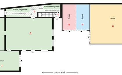
Commonhold properties
A commonhold property is a special form of co-ownership in which the co-owner has exclusive rights of use over his private portion and shares the common portions with the rest of the co-owners. This right is guaranteed by its registration in the land register.
GEO4ME prepares the documents required to set up a commonhold property for you.
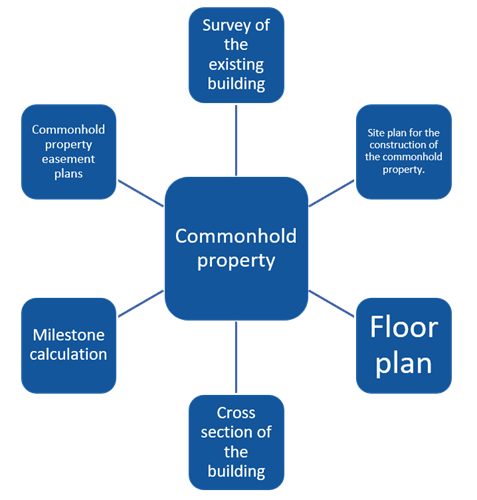
GEO4ME offers you its expertise and will work with your architect and notary to register your property in the land register.


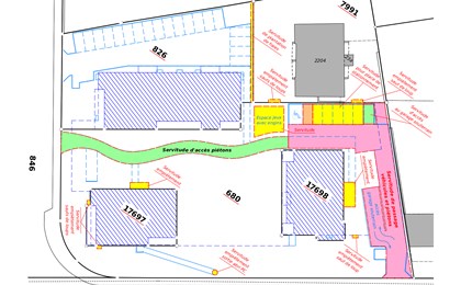
Private law restrictions (easements)
An easement is an encumbrance on a property that obliges its owner to tolerate certain acts from others or to refrain himself from doing certain things that he would normally be entitled to do.
It is a charge established on a building (plot) for the use and utility of another building (plot). The parcel benefiting from the right of way is the dominant estate and the parcel giving the right of way is the servient estate.

A distinction is made between related easements:
-
- Buildings (surface area, encroachment, building right restrictions, etc.).
- Planting and fences
- Rights of way
-
- Various uses (usufruct, outdoor use, use of premises, etc.)
- Pipework (wastewater, rainwater, drinking water, electricity, etc.)
- Others
The area over which the right is exercised is called the easement area. It is defined by an easement plan that is drawn up by an official surveyor.
In order to be effective and enforceable against third parties, the easement must be registered in the Land Register (LR). The notary registers the easement in the LR.
The easement is registered in the land registry. The modification or cancellation of an easement must be the subject of a new demand.
GEO4ME can advise you on the creation of your easement and will draw up the easement plan.

Taxation and expropriation
When the state or a municipality has to appropriate property with a view to a public utility operation, this is called expropriation. The surveyor helps the municipality to draw up an expropriation plan and a table summarising the expropriated areas, their values and any interest due.

The taxation of buildings is carried out by a municipal tax commission which is specific to each municipality. Some of our employees are members of such committees.
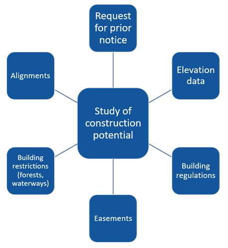
Studies of construction potential
On the basis of your property titles, GEO4ME will collect all the necessary data to analyse the construction potential of your property:
-
- Elevation data and contours
Topographic maps and elevation surveys - Building regulations (type of zone, density, binding distances)
- Easements (depending on the state of charges) Private law restrictions (easements)
- Elevation data and contours
-
- Building restrictions (forest and river areas)
- Municipal alignment planning
- Request for advance notice from the competent authority (Municipal or District Building Commission (DBC))
Expert appraisals
GEO4ME regularly carries out expert reports for the courts on specific issues relating to good neighbourly relations:
-
- Re-establishment of demarcation or definition of disputed boundaries
- Easements for inexistent pedestrian and vehicular crossings to be created by the judge
-
- Development of private plots and respect of legal distances (trellis, walls, trees, embankments, etc.).
- Right of use before construction or modification

References - Property management