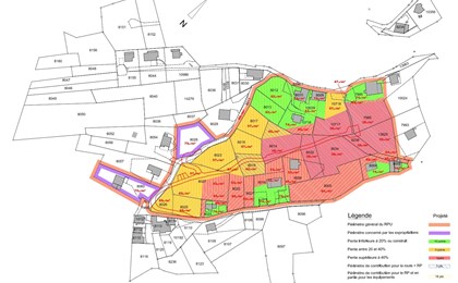
Facility programmes
Since 1 April 1996, the Federal Law on Spatial Planning has required a development programme for building zones. The programme specifies when and how public authorities are to equip building zones within 15 years. In order to draw up a development programme, it is necessary to draw up an inventory of the existing basic data concerning the zoning plan and municipal building regulations, existing roads, sewage and storm water drainage systems, the drinking water network and the electricity supply.
Based on this information, GEO4ME then assesses the areas to be equipped along with the facility requirements and defines the sectors to be equipped. A facility cost assessment, financial planning and a facility programme plan are also given to the municipal administration.

Expertise relating to the SPA
The Spatial Planning Act (SPA) is a legislative basis containing the goals and principles of Swiss spatial planning at the federal level.
The SPA is a complex piece of legislation using technical terms. However, it is addressed to any person having a direct or indirect link with the territory. This is why GEO4ME offers its expertise on all matters relating to the SPA:
-
- Analysis of the existing situation
- Support for communal decision-making
- Provision of tools combining GIS, spatial analysis and land use planning
-
- Calculation of surface areas by allocation
- Territorial planning scenarios

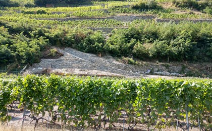
Cadastre forestier
An area covered with trees is considered to be forest if it meets certain qualitative and/or quantitative criteria. A minimum area of 800 m2 or if its nature conservation function is observed, for example.
The district's forestry engineer is generally in charge of drawing up an appraisal to define whether an area can be listed in the forestry cadastre or not.
GEO4ME takes note of the forest boundaries defined by the forest engineer and draws up approved plans for the forestry cadastre. These plans make it possible to precisely locate the forest boundary located on the edge of the area to be built.

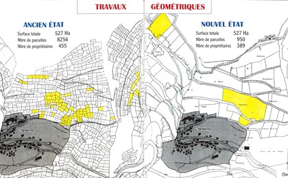
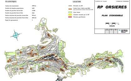
As-built suryeys and zoning / densification needs
Swiss land is an important natural resource that needs to be protected. The core of the built environment was created in the past and has been undergoing great changes ever since. An in-depth analysis of the built environment makes it possible to observe the dynamics of construction and its polarisation.
GEO4ME offers an in-depth analysis of the construction dynamics of your municipality in order to target objectives for the years to come. We also offer you support in the zoning process by providing you with a quantitative analysis of the municipality's needs in terms of the building zone and a qualitative analysis of the constructability of the land (location of the land, level of equipment, etc.).

References - Land use planning