Preliminary studies for agricultural support
The Department of Agriculture of Valais (SCA) is taking the opportunity offered by the 3rd revision plan for the Rhône (PA-R3) to establish a 30-year vision of the Rhône plain.
The preliminary studies for agricultural support (EPAA) and their maps (scale 1:10'000) constitute a guide which clarifies the issues at stake in the agricultural plain of the Chablais region of Valais and sets out the guidelines for strengthening agriculture with regard to future projects and concrete achievements.
GEO4ME brings you its expertise in its field and coordinates the various contributions of other specialists in detailed technical reports.

3rd correction of the Rhône
The aim of the first two corrections of the Rhône was to gain agricultural land at the expense of the river. However, today the Rhône is still prone to major flooding which leads to damage in surrounding areas. Contrary to the previous corrections which set up localised actions, the 3rd correction has a global view of the whole river and proposes a solution with a global vision.
GEO4ME can provide you with bathymetric measurements of the bottom of the Rhône river in order to, among other things:
-
- measure the depth of the Rhône river bed
- assess siltation near dams
-
- estimate the volume of excavation in the Rhone bed
GEO4ME also provides its expertise in the context of the acquisition of land near the Rhône in the Chablais region of Valais.

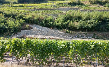
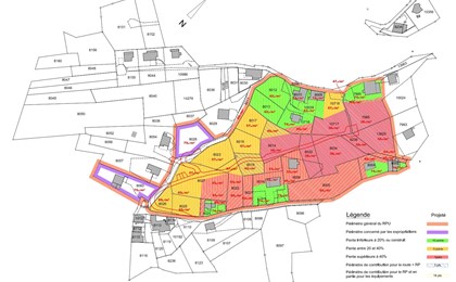
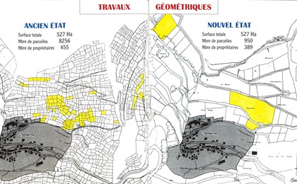
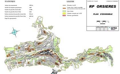
Agricultural plot reorganisation
In the past, when a piece of agricultural land was passed on to a person's heirs, it was customary to divide the plot according to the number of heirs. This resulted in a large number of small agricultural plots that were inappropriately arranged for optimal farming. Therefore, a reorganisation of agricultural plots can take place in order to create larger plots and to arrange them in an orderly manner facilitating their exploitation by farmers.
GEO4ME takes care of the entire process of parcel reorganisation.

Alpine pasture management plans
The alpine pasture management plan aims to provide a framework for optimising the use of an alpine pasture. The main steps in the creation of an Alpine pasture management plan are:
-
- analysis of current operations
- analysis of existing constraints according to economic, structural, human and environmental factors
-
- proposing a series of measures to improve operations and equipment.
GEO4ME carries out the study of alpine pasture management plans and their implementation in the form of structural improvement projects.

References - Land use planning