Swiss Land Registry (Cadastral) System
The Swiss cadastral system is made up of three main parts:
-
- cadastral surveying
-
- the "Register of public-law restrictions on landownership" (PLR cadastre).
-
- the land register (LR)
The Swiss cadastral system is made up of three main parts:
Cadastral surveying is a nationwide activity that delivers geometric data defining land ownership, and forms the basis for many other geographical information and applications in the fields of economy and administration or in everyday life.
The GEO4ME Group has extensive experience in cadastral surveying and will provide you with its expertise in the various stages of cadastral surveying.
Status of cadastral surveying in Switzerland
Information brochure: Cadastral Surveying in Switzerland:
a guarantee of security and prosperity
The Register of Public Law Restrictions on Landownership (PLR) is an information system that reliably collects up-to-date public law restrictions on landownership. These restrictions take various forms:
Our offices deal with the following PLR cadastre topics:
Our group is in charge of the acquisition and harmonisation of data concerning the PLR cadastres of the municipalities in Lower and Central Valais.
If you have any questions concerning the PLR register in communes in Lower and/or Central Valais, our office is at your disposal for information or you can visit the website sitonline.vs.ch.
The land register is a public register listing all rights in rem over buildings (properties).
The creation, modification, transfer and cancellation of these rights is recorded in the land register.
GEO4ME can perform various services for you:
Private law restrictions (easements)
Management of parcel boundaries
The municipal cadastre has plans of the entire territory as well as data relating to each building or plot. This data changes regularly through modifications in the deeds of sale, division, devolution, etc.
The book keeper and his/her deputy are responsible for keeping the cadastral documents in their municipality up to date.
At the municipal land registry you can:
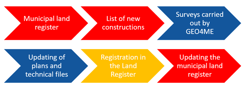
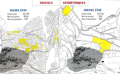
The purpose of updating the cadastral survey is to ensure that the items in the database are up-to date. Each modification (to add new items or, on the contrary, to remove obsolete ones) is called a mutation.
This update is continuous in the case of plots or periodical in the case of other items such as ground cover (buildings, natural boundaries ...). It is mandatory according to the Ordinance on Cadastral Surveying (OMO).
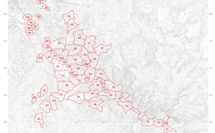
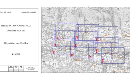
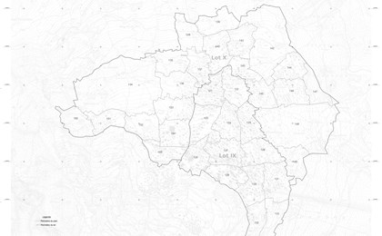
The GEO4ME group is currently in charge of surveying in the following municipalities: Bagnes, Bourg Saint-Pierre, Bovernier, Chamoson, Champéry, Charrat, Finhaut, Fully, Isérables, Leytron, Liddes, Martigny, Martigny-Combe, Monthey, Orsières, Port-Valais, Riddes, Saillon, Saint-Gingolph, Saxon, Sembrancher, Trient, Troistorrents, Val-d'Illiez, Vernayaz, Vionnaz, Vollèges, Vouvry.
To date, a large part of the above-mentioned municipalities is managed by GEO4ME and the data is available in our offices. As current cadastral survey lots are completed, the official survey data will be centralised in a cantonal database (BADOC). With this new management system, GEO4ME will be able to carry out transfers, survey plans and any other geometric work for you throughout the Valais.