Tools for managing different file formats
Do you know what information you want to collect but not how a database works?
We take care of structuring of your data and organise it so that it is usable.

Data processing
Do you have a lot of data and need to extract, transform or share it with your partners?
GEO4ME designs and implements advanced data migration and transformation procedures, guaranteeing that you take into account important constraints (topology, overlapping), and the qualitative monitoring of the data migration right up to the final delivery of the data.
The final result is delivered to you in the format of your choice; in the form of a file that you will be able to use and integrate into an environment linked to your overall project, or in a GIS available on the internet, or in the form of an interactive report.

Data Hosting
Are you looking for a solution to host your data? We can provide you with our hosting platform. Your data is replicated on several sites worldwide, in air-conditioned rooms that are monitored 24/7. The storage capacity constantly evolves in accordance with your wishes.
Support in data collection and analysis and application development
The first step in a project is to create the data. We can do the fieldwork for you but you can also do it yourself. In order to carry out this work, we will create a tool adapted to the needs of the project and, if relevant, we will provide you with material that will allow you to precisely locate the objects to be inventoried.
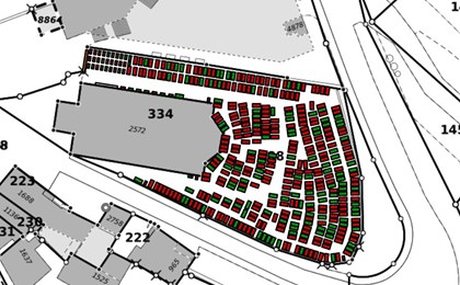
You can thus have a map showing the location of your vines, parking spaces in a car park, moloks etc.
To these objects you can add information such as the grape variety of the vine, the molok content, a point of interest in a race.
Once all this information has been recorded in a database that we make available to you, it is possible to work on this data. You can calculate distances between your objects, make statistics on the evolution of the data, visualise the objects that meet certain criteria (such as all the vines of the same grape variety or simply represent them on a map).

Reprographics
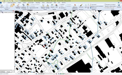
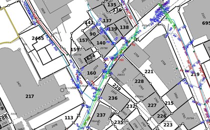
GEO4ME carries out automatic or manual scanning and vectorisation of existing plans. We also transform raster graphics into vector documents (DWG, SHP, etc.) that can be used in your GIS / CAD solutions in all types of documents:
-
- Technical drawings
- Cadastral map
- Underground cadastre
-
- Road maps
- Posters
After having been scanned, your plans can also be corrected, cleaned and printed again. Our large format printers can print plans up to 1.50m wide and 50m long.
References - Geoinformatics